Orientation by moss and lichen
Mosses and lichens do not like heat and light, so they grow in the shady side. This means that where there are mosses and lichens, there is north; on the south side there is less or no moss at all. Now orienteering on moss
will not present you with any difficulties. You can also determine the direction by looking at the soil around the stone. On one side it is relatively dry (south), and on the opposite side it is wetter (north). Usually an old, rotting stump is overgrown with moss on all sides. But to determine where north and south are, you need to check the moisture content of the moss, not the soil.
Anthill navigation
Another natural compass that will always help you find the right direction in the forest is anthills
.
Most of them are located on the south side of a tree, stump, or bush, since ants are heat-loving insects. The southern side of the anthill is usually sloping, the northern side is much steeper. Orientation by anthill. Navigating an anthill
is quite simple to remember and understand. In the tundra, as well as in white moss forests (more details:) and taiga swamps in the north of the European part of the USSR, in Western and Eastern Siberia, in the Far East, lichens (moss, or reindeer moss) of the genus Cladonia grow, which serve as an indispensable food for northern deer, especially in winter. Sources of valuable antibiotics and enzymes, they can also serve as a compass. Darker than the entire lichen, the tips of their branched bushes always face north. Therefore, when going north, you see the dark surface of the moss (lichen) cover, when moving in the opposite direction, that is, to the south, the dark color is not visible, and the bushes seem lighter
Tree navigation
If tourists find themselves without a compass in an unfamiliar forest area, they need to look carefully at the trees. In the south, the tree crown is more luxuriant and there are significantly more leaves. The densest branches in the dense forest develop here; the sun heats them better. Trees reach out for warmth with every leaf. In the north there are much fewer leaves and branches.
The method is not absolutely correct; allowances must be made for prevailing winds, the presence of moisture, and soil types. It is more reliable to navigate along lonely growing trees than in a dense forest.
You can navigate by the bark in a birch forest; from the south it is always lighter, more elastic and thinner. Roughness and cracks, dark growths form on the trunks of birch trees from the north. Birch is a very flexible, thin-trunked tree in young forests; the tilt of the trunk will indicate the direction of the prevailing winds.
You can navigate by the cut down stump; you just need to carefully examine the annual rings on it. Where the gaps between the annual rings are larger - south, and where the rings are located close to each other - north. It’s good if you come across a clearing with cut trees along the way. Even a few stumps will help confirm your orientation assumptions.
In the forests along which tourist routes pass, there are special signs called tourist markings. They are painted on the trunks along a planned route, always from the nearest populated area.
Forest “light bulbs” and “lighthouses”
In order not to get lost in the forest, you need to select clearly visible landmarks in advance, which help determine the location, direction of movement and measure the distance to the intended points along the route. The writer A. Avdeenko in his book “Above the Tisa” talks about his hero Kablukov like this:
“The thick fog did not prevent Kablukov from finding his way. By signs scattered here and there along the patrol path, he easily determined where he was. Here is the rocky bed of a ditch, washed by spring rains, which means that more than a third of the path has already been passed. After fifty steps there should be the stump of an old oak tree. Yes, that's right, here it is. In seven minutes, through the thickness of the fog, the bare trunk of an oak tree, broken by lightning, will blacken, then, on the other, on the right flank, a large boulder will appear, deeply rooted in the ground.”
In areas of the forest affected by honey fungus, there are peculiar, unusual landmarks - “light bulbs”. You are walking in the silence of the forest at night, and suddenly in the impenetrable darkness bright lights of phosphorescent light flash: the growing ends of the rhizomorphs of honey mushrooms glow. Rhizomorphs
are plexuses of honey fungus mycelium, very long, shiny black-brown cords, similar to electrical cords. As many rhizomorphs are around, there are as many “light bulbs”.
Honey fungus usually settles on stumps and other rotting remains of wood. The mycelium of the honey fungus, covered with a dense shell, is highly branched under the bark of trees, especially weak ones, penetrates with its branches into living wood, sucks the juices out of it and destroys the tree. The ends of the mycelium (rhizomorphs), protruding outwards, glow like bright miniature light bulbs. On a summer night, forest “beacons” can indicate the way along a winding taiga path. These are rotten things
, sparkling with phosphoric fire.
Rotten stumps phosphorescent most brightly. Trembling luminous streams “flow” from top to bottom along them. Myriads of bacteria nest here. Bioluminescent microbes contain complex chemicals - luciferin and luciferose. Different bacteria have their own fluorescents, differing in luminescence intensity and color. These lights gave rise to many superstitions. But the cold light at night has a simple explanation. This is bioluminescence
, that is, a living glow, especially active in windy weather, with an abundance of oxygen and moisture. It doesn't stop around the clock. So, in order to avoid wandering in the forest at night when returning from a route taken during the day, it is advisable to remember in advance the location of rotting trees or dilapidated stumps, which will serve as kind of light indicators along the way; in addition, orientation by moss or anthill will help you find the right direction.
A real tourist is never lost, he is simply exploring new territory! But what do you do in an unfamiliar wilderness if you don't have a compass or GPS with you? There are a number of orientation methods that allow you to do without a compass and navigation devices.
Exterior view of the ant house
An anthill outwardly resembles a mountain of blades of grass, twigs, and pieces of soil, but in reality it is a well-organized dwelling, inside of which interesting life is in full swing. From above, the anthill structure is a cone-shaped mound with small openings-entrances. This shape is not accidental - it allows the anthill to be well warmed up by the sun, not to get wet when it rains, and to receive the necessary access to oxygen.
Over the years, the anthill grows to several meters in height. Raindrops that fall on the outer layer do not penetrate inside. The open entrances, which are guarded by a large army of soldiers, are ventilation shafts through which air constantly flows into the ant house. In the Tomsk region, scientists discovered a huge anthill 3 meters high and about 5 meters in diameter. Experts believe that this structure took about 20 years to build.
Orientation by mosses and lichens
One of the most well-known methods of orientation on the ground is by mosses and lichens. On the northern side of tree trunks and stones, moss grows more abundantly than on the southern side, due to the fact that the sun dries it less (Figure 3). Moss almost always grows on old stumps, which can also serve as a guide: although a stump may be covered with moss on all sides, it is wetter on the north side.
Figure 3. Moss grows on the north side of stumps and trees.
It is also worth paying attention to the soil around the stone: on the south side it is relatively dry, on the north it is more humid.
Orientation by temples and glade pillars
If you need to get your bearings and an Orthodox Church is visible not far away, pay attention to the cross crowning the dome of the church. The lower oblique (diagonal) crossbar of the cross points with its lower part to the south, and with its upper part to the north (Figure 5).
Orthodox churches are built strictly with orientation to the cardinal directions.
If you find a clearing in the forest and move along it, sometimes you can find a post with numbers indicating the number of the “square”. A cutting post can help determine the cardinal directions: the numbers with the lowest value point to the north.
Figure 5. Clearing pillars and Orthodox churches will also help you determine the direction
Orientation by the stars
Orientation by the stars is one of the most reliable options for determining the cardinal directions. At the same time, this method can be difficult for a beginner - not everyone can find the right constellation. The main thing is to find the North Star in the sky; it is not the brightest in the night sky, as many people believe.
Navigating by the stars takes some practice.
If you may need to determine the cardinal directions from the starry sky in the future, it is advisable to practice in familiar (not camping) conditions.
In the Northern Hemisphere, the North Star is always above the northern point of the horizon (the difference between the North Pole and the North Star is 1°), this makes it an indispensable “assistant” for orientation on the ground (Figure 6).
Figure 6. The North Star has been helping to determine direction for several hundred years.
In the starry sky you need to find a specific figure of 7 bright stars of the Ursa Major constellation, visually reminiscent of a ladle with a handle. 3 stars “form the handle”, 4 – the “capacity” of the bucket itself. It is necessary to speculatively connect 2 stars (Dubhe and Merak) located on the right edge (wall) of the bucket with a straight line. Next, continue the straight line (conditionally set aside 5 times the distance separating the mentioned Dubhe and Merak) to the star located on the edge on the represented “handle” of Ursa Minor (also a smaller “bucket” of 7 stars). This star is Polaris (always points exclusively to the north). The height of the star above the horizon coincides with the latitude of the observing person.
In the Southern Hemisphere, the starry sky is radically different from the Northern Hemisphere. The main reference point for the cardinal directions in the Southern Hemisphere is the Southern Cross constellation (Figure 7), consisting of 5 bright stars. 4 stars are speculatively arranged in the shape of a cross. One of the conditional lines will exceed the second in length - one of the stars of the Southern Cross is observed further than the others, you get a kind of cross with a handle that needs to be visually extended 4 times and “drawn” vertically to the horizon line - the south has been found! If you wait for the moment when the Southern Cross stands vertically in the sky, then the handle will be directed strictly south. When observing, it is important not to mistake the False Cross (not pointing to the South Pole) for the Southern Cross.
Figure 7. Another assistant in the sky at night - the Southern Cross
You can also use the constellation Orion, which points to the east and west, for orientation by the stars. In practice, orientation by Orion is much more difficult than by the Southern Cross. For orientation, 3 bright stars on the constellation belt are used: at the moment of sunrise they are directed to the east, at the moment of sunset - to the west.
Orientation by the sun and stars
To navigate by the Sun on a bright sunny day, you should wait until midday. At this time, the luminary is at its zenith, any shadow cast by objects becomes short. You should stand with your back to the luminary; the tourist’s shadow will indicate the direction to the north. The south will be behind the traveler. On his right hand there will be an eastern direction, on his left hand - a western direction.
In the off-season, on spring and autumn days, the sun will rise strictly in the east and set in the west. At noon in any season, the star is in the south and every shadow points to the north. On winter days, the sun will rise from the southeast and set from the southwest. On summer days, the sun will rise from the northeast and set from the northwest.
Any traveler has an idea of the constellations of his northern sky. Today, almost every schoolchild can find the stars Ursa Major and Ursa Minor in the sky. But although tourists may theoretically know that the North Star is the end star on the tail of Ursa Minor, finding it can be quite difficult. The advice to help with this is to find the two terminal stars in Ursa Major and mentally continue the line connecting them to the bright Polar Star. Standing facing it, the tourist will look north.
Table: determining parts of the world by the sun
Orientation by the moon
Navigating by the moon is quite difficult, and the accuracy is not very high. But sometimes this is the most affordable way. The moon is often visible even through dense cloud cover when the stars are not visible.
The moon goes through a series of phases of solar illumination:
- New Moon – The Moon is virtually invisible.
- First quarter – the right half of the Moon is illuminated.
- Full moon - the entire disk of the moon is illuminated.
- Last quarter – the left half of the Moon is illuminated (Figure 8).
If the crescent moon conventionally resembles the letter “P” - the Moon is growing (before the full moon, including the first quarter), if the letter “C” is aging (after the full moon, including the last quarter). Growing is more often observed in the evening, aging - in the morning. The full moon is the most favorable time for determining the directions of the horizon.
Figure 8. Moon phases
In the first 1/4 the Moon is approximately located:
- 19:00 – south;
- 1:00 – west;
- 7:00 – not visible.
During a full moon, the Moon is approximately located:
- 19:00 – east;
- 1:00 – south;
- 7:00 – west.
In the last 1/4 the Moon is approximately located:
- 19:00 – not visible;
- 1:00 – east;
- 7:00 – south.
You can also navigate with the help of a clock, just like by the daylight, but it is not the time of true noon that is determined (a person orients himself by the Sun), but the moment of the upper culmination. During the full moon, this moment and local midnight coincide, orientation along the full disk of the Moon is carried out similarly to orientation towards the Sun.
The problem is that it is impossible to speculatively determine whether the Moon is in the full moon phase.
For several days before and after the full moon, the appearance of the night star is almost unchanged, and the deviation, which is caused by an incorrect phase, can be very significant; the lunar disk shifts by 12° per day.
In 1/4, the Moon reaches its climax 6 hours before midnight, in the last 1/4 - 6 hours after local midnight. Since the 1/4 moment is visually determined easily, the orientation is performed more accurately.
There is a general rule for orientation with the help of the Moon - you need to speculatively divide the diameter of the night luminary into 12 shares and determine how many parts the unlit part of the Moon occupies - exactly how much will the time of culmination differ from the local midnight. The waxing moon culminates before 00:00, the aging moon - after.
The greatest deviations with this method are possible closer to the new moon and full moon. With some experience, the sides of the horizon can be determined with an error of up to 10-15°.
Sun orientation
In clear weather, you can navigate the area using a mechanical watch. The large hand of the clock must be turned so that it points directly at the sun. Afterwards, you need to visually draw the angle between the hand aimed at the sun and 13 o’clock (1 hour). Through a given acute angle we draw a bisector dividing the acute angle in half. We mentally imagine an arrow lying on this bisector; this arrow will point to the north. Before noon we divide the angle located before 13:00, after noon we divide the angle formed after 13:00 (Figure 9).
How to navigate by the cardinal directions if you are in the forest? and got the best answer
Answer from Condorita[guru] I navigate in the forest by lichens (my grandfather taught me as a child), everything else is below
There are several ways to navigate in the forest without a compass: by tree branches by rings on a cut tree by lichens on stones and a tree trunk by spring melting of snow (if it’s early spring) by an anthill By tree branches If you look at the diagram, you can see that a separate tree has fewer branches on the north side. We stand facing north and determine the rest of the world. From the rings of a cut tree, it will be clear from the cut of a stump that the rings are located (displaced) to the north and extend to the south. We stand facing North and define South, East and West. By lichens If you look closely at the tree trunk, you can easily notice: on the north side of the tree trunk there is more moss. The same rule applies to stones - moss grows on the north side. According to the spring melting of snow If you get lost in the forest in early spring, then you should pay attention to the melting of the snow: on the north side the snow melts noticeably longer. By anthill The most famous and popular method: the anthill has a gentle slope in the south - and a sharper, steeper slope in the north, just as anthills are usually located south of the tree. Determining the cardinal directions If you turn your face to the NORTH, then there will always be SOUTH behind, WEST on the left, EAST on the right. the bark of most trees is coarser on the north side, thinner, more elastic (birch is lighter) on the south; in pine, the secondary (brown, cracked) bark on the north side rises higher along the trunk; on the north side, trees, stones, wooden, tiled and slate roofs are covered earlier and more abundantly with lichens and fungi; on coniferous trees, resin accumulates more abundantly on the south side; anthills are located on the south side of trees, stumps and bushes; in addition, the southern slope of the anthills is gentle, and the northern slope is steep; in spring, the grass cover is more developed on the northern edges of the clearings, warmed by the sun's rays; in the hot period of summer - on the southern, shaded ones; berries and fruits acquire the color of maturity earlier (turn red, turn yellow) on the south side; in summer, the soil near large stones, buildings, trees and bushes is drier on the south side, which can be determined by touch; snow melts faster on southern slopes; as a result of thawing, notches are formed on the snow - “spikes” directed to the south; in the mountains, oak often grows on the southern slopes. Other features: clearings in large forest areas, as a rule, are oriented in the north-south and west-east directions; the numbering of forest blocks in the USSR goes from west to east and further to the south;
Every fisherman needs an assistant, so in their work they use a bite alarm with their own hands; making it is not at all difficult. This device can report that a fish has touched the bait, and also suggests the most appropriate moment to hook. Today in specialized stores you can find a wide selection of such useful devices, but they are not always nearby at the right time. Therefore, it is better to familiarize yourself with how to make a bite alarm with your own hands.
- How to make a visual alarm yourself?
- Homemade sound devices
There are many types of this homemade device. Every experienced fisherman has his own.
They can be divided into the following models:
- pendulum;
- nodding;
- sound;
- electronic.
The first option is the simplest. It is made from twigs, lumps of clay, which are suspended near the end of the rod on the main line. However, this bite sensor has its drawback. So, they are silent, and the impact of clay (wood) quickly wears out the main line.
But the nodding device is considered the most perfect. It differs in that it reacts even if the smallest fish bites.
An audible bite alarm is necessary when fishing takes place not with one, but with several fishing rods. Such models can be very diverse. You can take a banal brass sleeve. But it can also be a more complex design.
If we talk about electronic signaling devices, these designs can also be different. They should be attached to the form in front of 1 or 2 rings.
However, the best option is considered to be combined ones, which are capable of delivering not only a visual signal, sound, but also light.
In addition, it is recommended to always have several devices with you to respond to bites. For example, when it is windy outside, the rods should be positioned horizontally, this will reduce the air flow directly affecting the action of the blanks. In this case, it is the pendulum device that will work perfectly, which additionally needs to be equipped with a rattle. Then you can fish with several fishing rods.
Which devices are best to use should be decided depending on the fishing conditions, that is, individually for each specific case. In any case, the main thing to remember is that the alarms begin to react when the fish swallows the bait. Therefore, this weapon is considered simply irreplaceable.
How to make a visual alarm yourself?
Most fishermen use visual alarms to detect bites.
To build such models, you cannot do without:
- float;
- rod tip;
- additional beacon;
- firefly lighthouse (if fishing at night).
So, if you decide to make a homemade bite alarm from a float, then you can use a cork, a feather from a large bird (for example, a goose), or a twig. These devices should be attached to the fishing line using an elastic band.
A nod made independently will signal inactive prey. Those made of springy metal wire have proven themselves well. A plate will also do. The nod should be attached with adhesive tape to the top of the rod. It should be noted that it is the nodding signal that is most often used.
Those who like to fish at night prefer bite alarms in the form of a firefly. This light option requires a soft polymer tube, which must be baited on the edge of the rod. Afterwards, a luminous type indicator is attached to the other side. If the tube and the mount are incompatible, clear adhesive tape will do the trick to secure them in place. If the firefly is needed for constant use, then it should be stored in the freezer.
The simplest device is a tube made of foil. You need to secure it to the fishing line. Such a model will change its position if the fishing line becomes taut. In addition, it will be clearly visible at night. However, this unit has a high windage capacity, so during windy conditions it is worth using another option.
Homemade sound devices
If a person has an ear for music, then he can easily determine which fishing rod was triggered by the bell. They are easy to make yourself. To do this, you will need a piece of metal pipe, where a tongue is placed inside, for which a bolt or nut is suitable. The mounting here will also be very simple. A clothespin works great for this.
Separately, it is worth highlighting the correct bell, which is distinguished by its fixation on the feeder. There are two methods of fastening.
- Any household clamp is a simple and effective method.
- Connecting a wire with a hook is the most reliable option.
You can easily make an audible bite alarm with your own hands using a bell. This option will be the most basic. Bells have different tones and vibrations.
Mechanical alarms are divided into several types:
- sensitive nod;
- monkey;
- swinger.
The method of constructing the nod was described above. This could be the tip of the rod or the float. Its operating principle is quite simple. So, when the fishing line is stretched, the nod begins to bend.
The monkey looks like a weight. It is also attached to the fishing line, and it is located among the reel and the input ring of the rod. The weight creates a slack in the fishing line. The fish begins to peck and this sag gradually decreases, which is why the monkey moves.
The swinger looks like a small plastic head with a clamp. It is fixed on a lever with a weight. Thus, mechanical devices are very simple, which is why they are so easy to make with your own hands.
So, the fishing line must be passed through a special hole in the corresponding device where the wheel is located. It will rotate and signal when the fishing line is pulled. The fisherman will receive a signal in the form of sound, vibration and light.
Why are these types of models in demand today? The fact is that you cannot move away from a mechanical tool, since you can miss the necessary moment. However, it is not always possible to constantly monitor the rod. An electric beacon will do this perfectly.
He doesn't need constant presence. There is a wide selection of these products in stores.
They can be:
- visual;
- sound;
- combined.
Of course, any angler is constantly improving his gear according to his own understanding and inclinations. At the same time, it is worth trying all the types of alarms that were given above, which react differently to a bite. Thanks to this, fishing will become a real creative process, even more exciting and interesting.
Their operating principle is the closing and opening of electrical circuits. To make the simplest version, you will need several parts. But it is important to follow some rules.
- The keychain that is used as a basis must have a certain melody.
- It is attached to the feeder, namely to its stand, but the contacts must be in a closed state.
- They are brought out as two plates.
- In the area where the coil and the first ring are located, a piece of plastic (1 mm thick) should be fixed.
- The second end must be inserted among the output contacts.
It should be understood that the signaling device is an important element for successful fishing. If you get acquainted with all the rules for its manufacture, you can quickly and easily build it with your own hands. Any model will be easy to use and effective.
Often, when going on hikes, people repeat the necessary information that they may need in the impenetrable thickets of forests and other wildernesses.
Before the hike you should:
- Take the necessary equipment with you;
- Repeat the required information;
- Try to anticipate all possible situations.
The most important factor in any trip, hike or adventure is location orientation. Depending on the conditions of stay, a number of auxiliary elements are suitable for certain conditions, such as a map or compass.
Anthill diagram
Anthill diagram
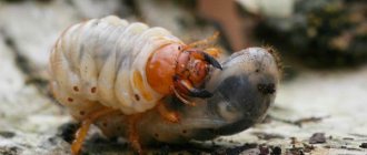
Ants always choose the place for the anthill and materials for the house carefully. The anthill itself consists of an above-ground part and an underground nest. On top it is covered with twigs and needles, which protect the home from bad weather. And even if it looks unattractive in appearance, there is a whole town inside.
Inputs and outputs
Anthill in section
Entrances and exits serve not only for entering and exiting, but also perfectly ventilate the room. The strongest and largest ants guard the entrance to the anthill, covering it with their bodies. Before it rains, the entrance is closed to ensure that all passages and chambers remain dry.
Solarium
This is usually the upper chamber, or room. Due to its location, it heats up very quickly and ants come here to warm themselves. And in the spring, they can spread heat on their bodies, warming up the entire anthill.
Interesting: The most dangerous insects in Russia - list, names, descriptions, photos and videos
Cemetery
If you go lower down the anthill, you may stumble upon piles of dead ants and garbage. All this is put into a separate cell, which is not very deep and not far from the ventilation.
Wintering chamber
Like bears, ants also hibernate to survive the harsh cold. For this they need their own den. Usually it is located somewhere in the middle of the anthill.
Storage
Ants store plant seeds in storage in case they cannot find food for themselves. Some ants take care of the food and even take it out into the sun to dry it.
Royal chambers
The queen of ants, the queen, lives in the royal chambers. Usually she is also the first resident in her colony. The queen very rarely leaves the anthill. The whole point of her life is to lay eggs.
Nursery and kindergarten in an anthill
These are chambers in which eggs, larvae and pupae are stored. Nannies are nearby all the time, because the larvae need food and round-the-clock supervision. They move them up or down the anthill depending on the weather, trying to always keep them warm and in the required humidity.
Pantry
The place where all the most nutritious things are located. This is where the ants store caterpillars and other food they have caught.
During its life, an ant can perform only one job, and can even change with other ants. But he carries out any assignment with great precision and dedication. Work that requires great physical exertion is often performed by young and hardy ants.
Interesting: Lifestyle of insects - description, photos and videos
Landmark - anthill
One of the surest factors can be an anthill. It is a nest in which a large number of ants live. It consists of many leaves, various tree branches and much more. There are many varieties, shapes and sizes of anthills. Their dimensions can vary from a few centimeters to several meters, and have a more round or dome-shaped shape.
You can usually find an anthill near some plant: a tree, stump or bush.
The shape of the anthill is not symmetrical. Typically one side is flatter and the other is steeper. The part of the structure that has a steeper slope defines the northern side. The slope, which has a smoother descent, points to the south. This is due to the fact that ants are more heat-loving insects, as a result of which they are more drawn to the south side, which is naturally warmer.
Also, the very location of the anthill may indicate the direction; they usually occupy places on the southern part of any plant. This is due to the fact that cold winds blow from the north. Thus, another plant becomes a living barrier that prevents cold air from blowing through the anthill.
How to navigate an anthill in the forest
A landmark that will never let you down is a simple anthill. Ants live in almost any area. There are about 12,000 species of them and they adapt perfectly to any conditions. They do not live only in harsh natural conditions, such as deserts and cold northern regions. They are heat-loving insects and predominate mainly in warm regions. In conditions close to harsh, for example, in a temperate climate, they hibernate during the winter.
Anthill orientation
There are a huge number of types of ants and anthills, but the principles of their construction are the same. So, how can you navigate an anthill? The rules of reference are quite simple. Since ants prefer warmth, they build anthills on the south side of trees or other vegetation. Cold winds usually blow from the north, and the wide trunk of a tree serves as an excellent barrier from the wind. If you see a large anthill next to a tree or bush, then south will be exactly in the direction of the anthill from the tree.
There is another important feature of the anthill. The shape of the anthill will help you determine how to navigate the terrain using an anthill. If you find an anthill in a steppe area and it stands separate from the vegetation, it’s not a problem. The fact is that any type of anthill has a flatter shape on one side and steeper on the other. The flatter side is located towards the south, and the steep side is towards the north. This feature is again due to the fact that ants love warmth and the steeper side serves as a barrier from the wind.
However, the anthill is an imprecise natural landmark; the celestial bodies are more accurate. You can read how to navigate by the Moon and how to navigate by the Sun on our website.